Aerial surveys are ideal for a variety of requirements and used by surveyors, building companies, maintenance departments and marketing.
Reasons why to use our services :-
Our aircrafts (drone) are professional machines than can take 4K images and video footage, have GPS technology for precise flying and recording.
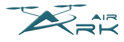
Photographs can be enlarged or you can freeze frame video for precise evaluation.
Due to our intensive PfCO training it is safe, quick and less expensive than traditional methods.
No more worrying about access issues when using cherry pickers, lift baskets and height limitations.
No need for expensive scaffolding.
We can survey upto 400ft, even higher with clearance from Air Traffic Control (ATC) and the Military (UKLFS).
We carry out a site survey and risk assessment prior to every deployment and adhere to strict safety procedures.
- Civil Engineering Work
- Building Surveys
- Insurance Claims
- Marketing
- TV & Film
- Perimeter/fencing Surveys
- Repair and Maintenance
- Roof Survey
- Site Progress
- Geological
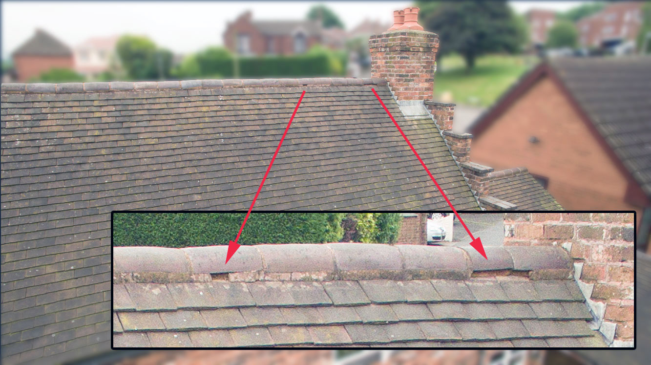
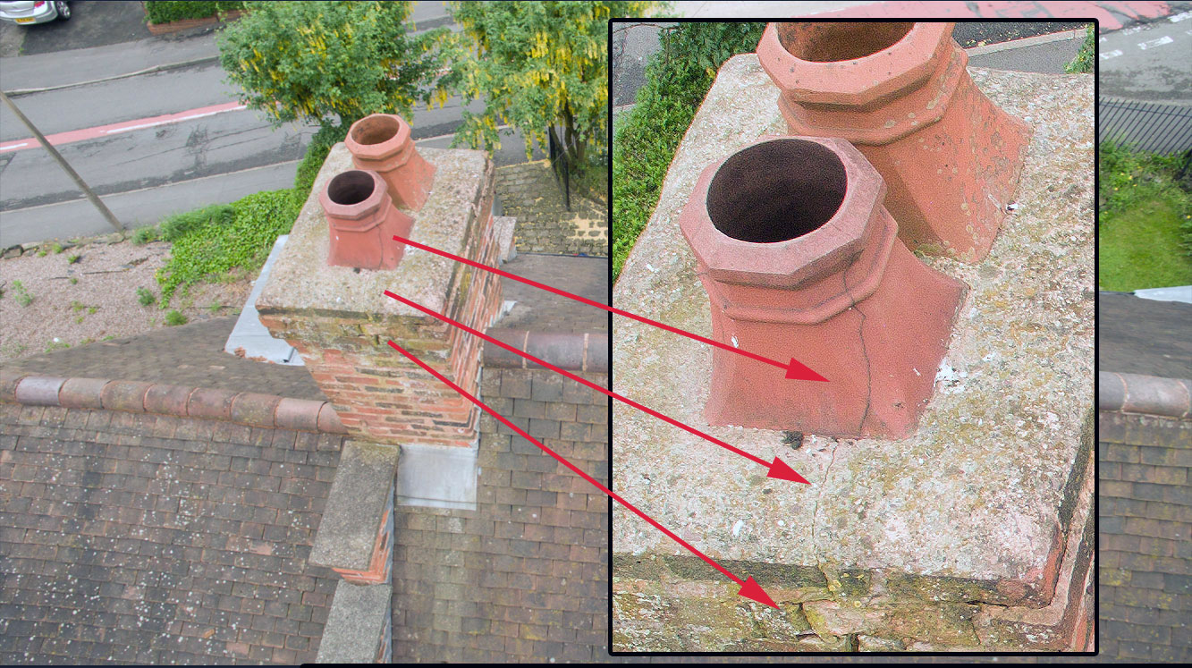
Below are examples showing 2D high image resolution survey of canals and foot bridges
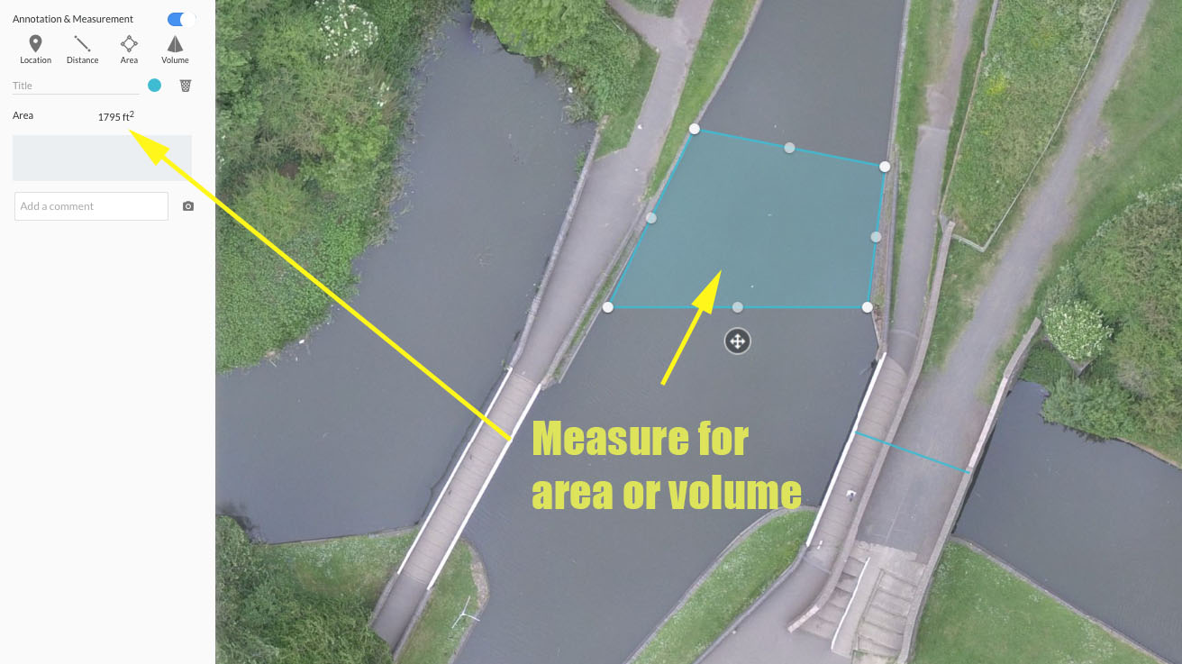
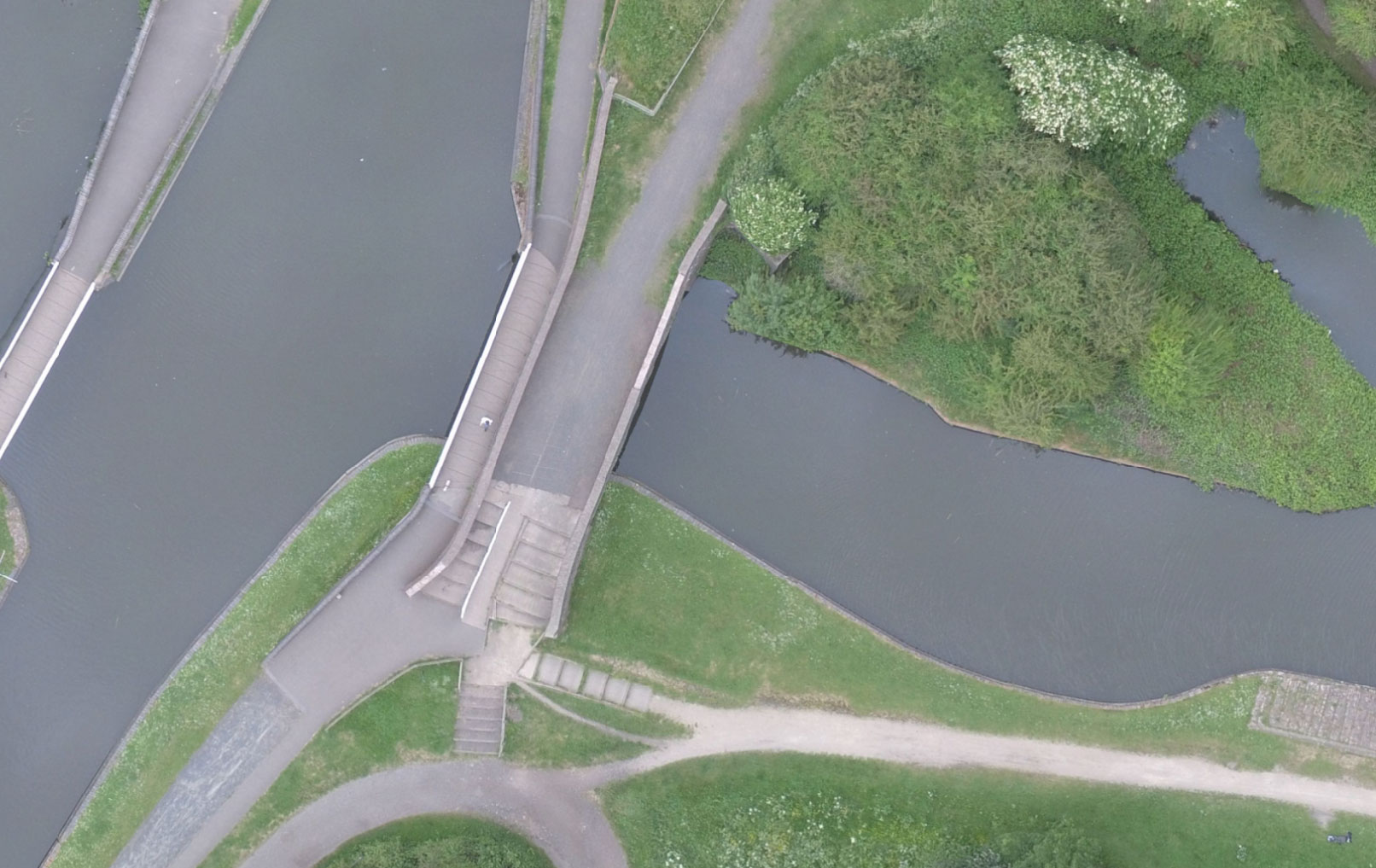
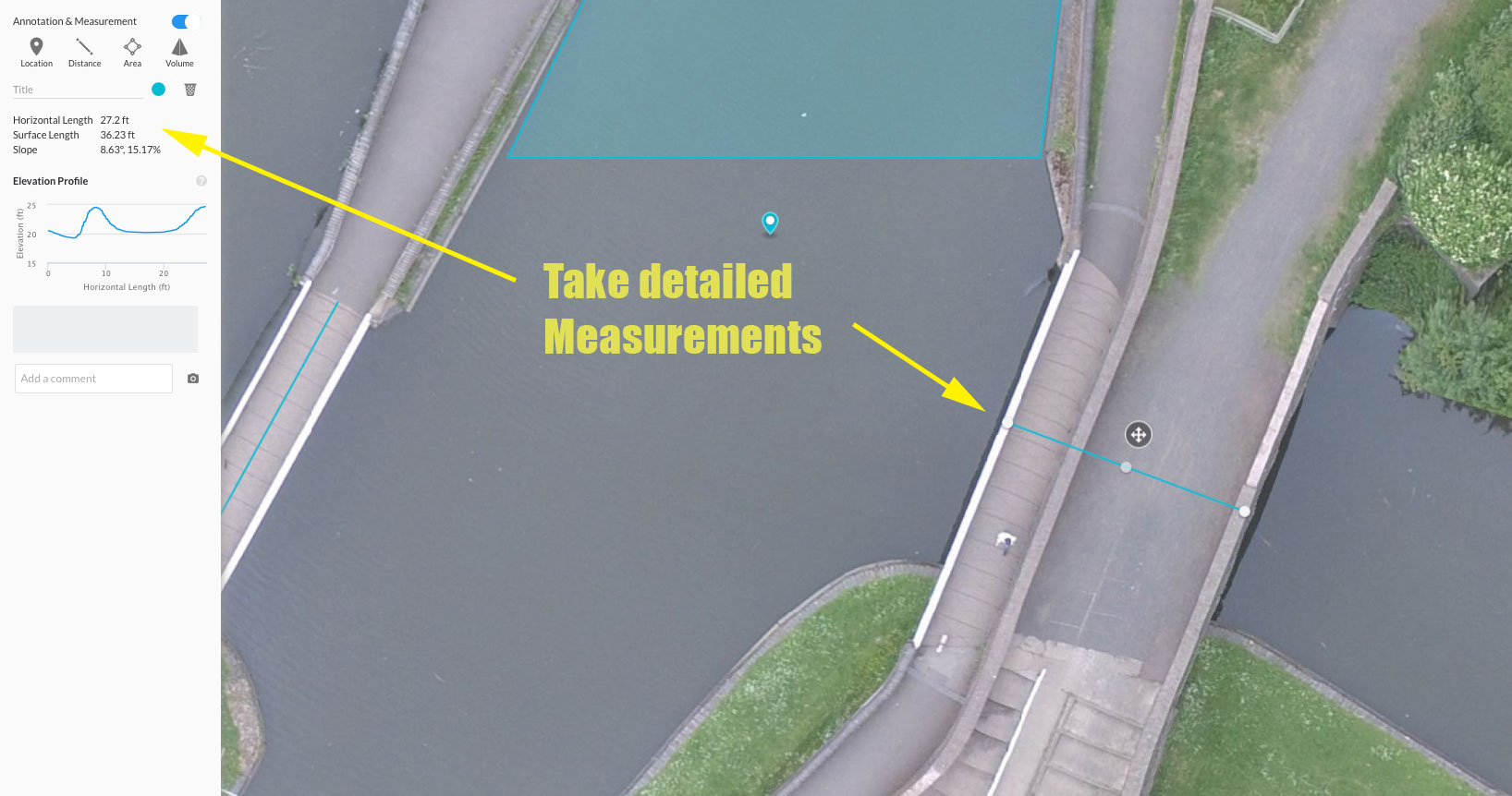
The four example images above show where the UAV flied at 200ft on a configured course set by the pilot. The survey consisted of a number of photographs taken to produce a large high-resolution image. The accuracy of scale is within a few centimetres so detailed measurements can be taken to help with planning or CAD design on installations, renovations or pre-build surveying. It is an additional tools that can be very helpful for many projects.
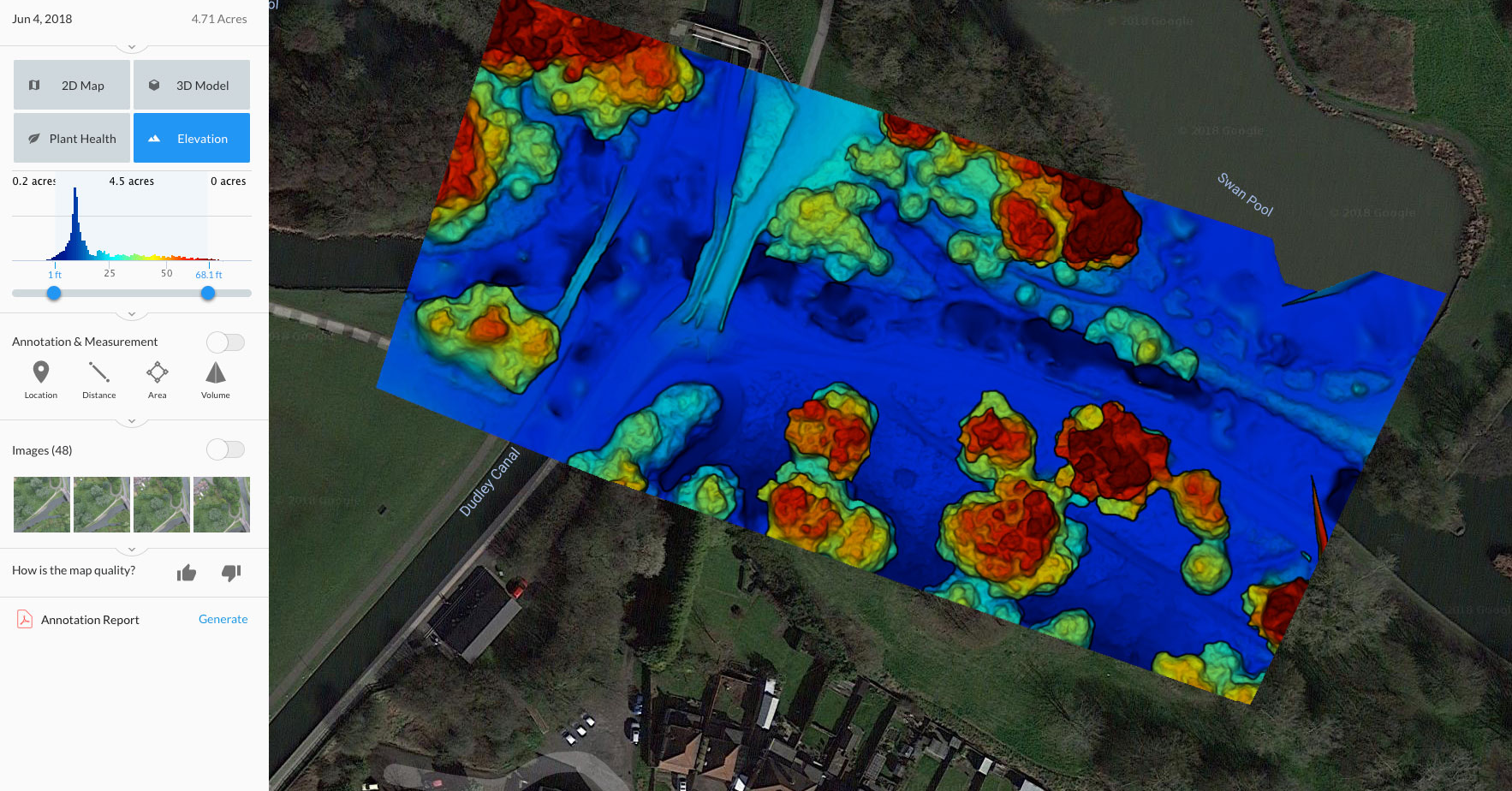
The image below shows the elevation of the area surveyed, red is high blue is low.
For an instant quotation click here or give us a call on 0121 246 4610, we are here to help and provide solutions.